2022 Hurricane Season Forecast
We are already two months into hurricane season but we decided now is a good time to do a seasonal hurricane forecast. Better late than never, right? We’re also in good company, NOAA and Colorado State have also recently released seasonal forecasts1,2. The thing is, in the Atlantic, hurricane season doesn’t really get going until August. Virtually all of our major impacts occur in August, September, and October.
But first a recap: Last year was predicted to be above average; a typical season has 14 tropical storms but last year had 21! Most of these storms were short-lived and weak, but Hurricane Ida slammed hurricane-weary Louisiana as a category 4 and became the 5th costliest storm in U.S history3. Louisiana was already recovering from four storms the previous year. I actually had a chance to collect data in this storm (see pictures and video below from this research mission). Ultimately, predictions were right in calling for an above average season.
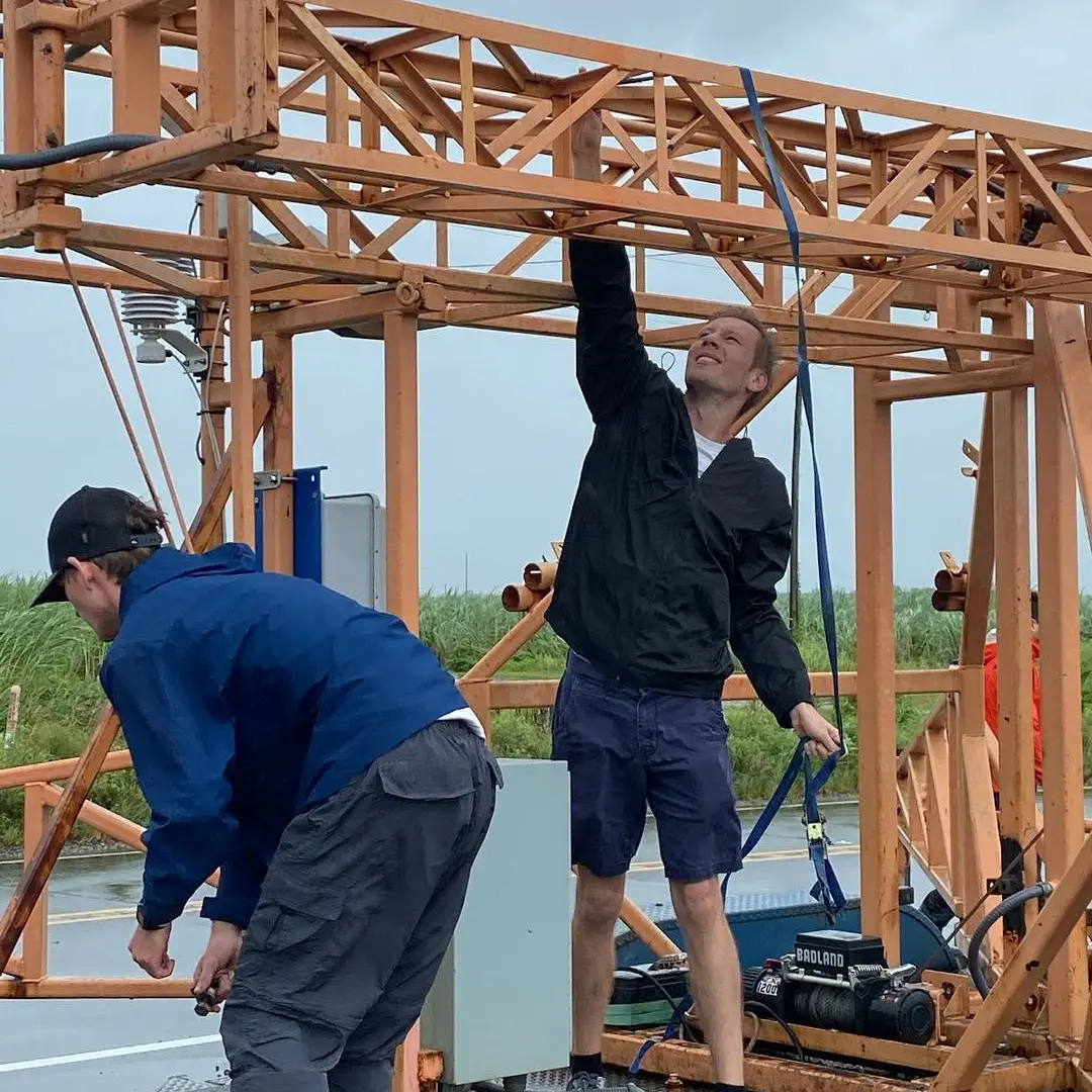
Here I am helping to set up an observation tower in Raceland just prior to Ida’s landfall, it was already raining and winds were gusting to tropical storm force.
This is the last video I took in New Orleans before hotel staff closed off doors to the outside. Winds gusted to hurricane force, knocking down trees, tearing the roof off the adjacent building, and blowing the AC unit into our room.
Guess what?
This year we can expect another active hurricane season.
Should we have hurricanes for dinner? We have the ingredients
The expectation for an active season is mostly because of La Niña, i.e. cold ocean temperatures in the tropical Pacific Ocean, and how this affects Atlantic hurricanes seasonal can be found in our first seasonal hurricane prediction post. Currently, water temperatures in the East Pacific are pretty cool ![]() . We are so close to peak hurricane season and we are past the spring predictability barrier we have high confidence that La Niña will persist. This will result in gentler upper level winds allowing hurricanes to form and strengthen without being decapitated.
. We are so close to peak hurricane season and we are past the spring predictability barrier we have high confidence that La Niña will persist. This will result in gentler upper level winds allowing hurricanes to form and strengthen without being decapitated.
There are three other factors mentioned by Colorado State and NOAA that indicate an active hurricane season this year:
- The Atlantic trade winds are weaker than normal and likely to persist through peak season which will mean reduced wind shear which will allow hurricanes to develop and strengthen more readily.
- Sea surface temperatures (SSTs) in the main development region of the Atlantic are also above normal which will provide more fuel for storms.
- Finally, the African monsoon has been more active (rainy) than normal. This means there is less dry dusty air. This also means more robust African Easterly Waves, which are clusters of thunderstorms that are the seeds for most Atlantic hurricanes.
What's that noise? The physical limits of predictability
Is there a way we might be spared an active season?
It is not likely, Colorado State and NOAA haven’t been wrong about their seasonal forecast (at least with respect to whether it will be an active season or not) in nearly a decade. But, this might be a good time to dive into some examples of noise and how that can affect our forecasts.
Our first example is 2010 which was a very active hurricane season, and this was actually forecasted very well. However, nearly all of the season’s strongest storms stayed out at sea. The U.S saw no hurricane landfalls, and damages from the season were relatively low especially for the number of storms. The forecast was accurate but, to many people, it didn’t seem that way because most of the major storms didn’t make landfall. On the flip side, a very inactive year can still produce a one monster storm that turns out to be very devastating like Andrew in 1992 or Alicia in 1983. Because hurricanes are such rare events and because we can’t predict hurricane tracks more than a week out, the relatively random path of hurricanes will mean a lot for the overall impact of the season.
The past examples are perceived misses, but we do sometimes get the forecasts wrong because of chaos in the atmosphere. An infamous example is the 2013 hurricane season. ENSO was cool neutral and Atlantic SSTs were warm; there were even a few early season storms that indicated the Atlantic was all-systems-go to produce hurricanes. But that year there were only two hurricanes, the fewest in 30 years (and no major hurricanes). All seasonal forecasts that year completely missed this meteorological dud of a season.
The culprit? Dry air from the mid-latitudes kept sinking into the tropics. The mid-latitudes are characterized by jets and temperature gradients; it is basically weather in the fast lane. Compared to the tropics, where weather is dependent on slowly varying ocean temperatures, mid-latitude weather is very hard to predict at long range because of the variable jet stream (we explain this further in the “Jet Stream” section of this NAO post). While we have a good grasp of most features that impact hurricane season activity, this mid-latitude weather is always there and serves as a wild card, a source of noise that can ruin our forecast.
We have learned from 2013 and found that these mid-latitude intrusions are more likely when the subtropical Atlantic SSTs are cooler. This year we actually have cooler than average subtropical SSTs north of the main development region, so hopefully we can get another season like 2013. Well hopefully for you all, but us meteorologists who want to make accurate forecasts and put anemometers in hurricanes might be a little disappointed.
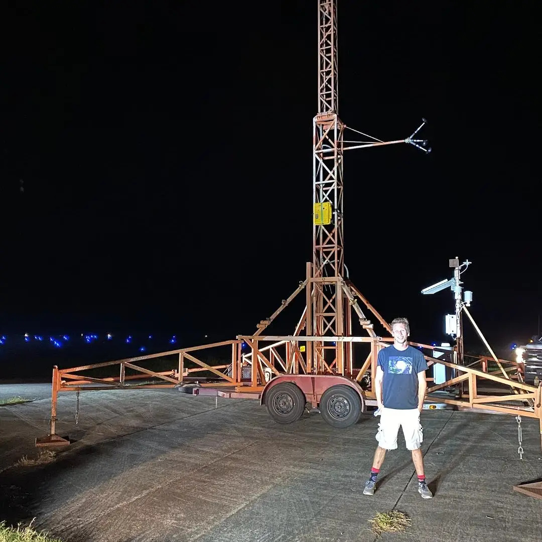
Here I am “helping” set up an observation tower with the FSU team in Galiano LA the night before Ida made landfall there. I also (actually) helped place several storm surge instruments here.
Footnotes:
1NOAA Climate Prediction Center 2022 Atlantic Hurricane Season Outlook
2Colorado State University Seasonal Forecast for 2022 Hurricane Activity
3NOAA National Centers for Environmental Information (NCEI) Costliest U.S. Tropical Cyclones